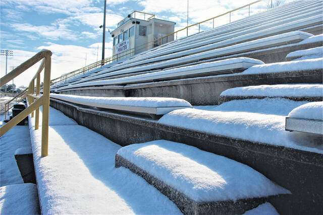
Alton G. Brooks Stadium at Lumberton High School is covered in snow on Jan. 22, 2022, after about two to three inches of snow fell in the area.
Chris Stiles | The Robesonian
LUMBERTON — The National Weather Service issued a Hazardous Weather Outlook Friday, forecasting cold, windy and rainy weather today through Wednesday.
“This Hazardous Weather Outlook is for southeast North Carolina and northeast South Carolina,” according to a statement released to local media on Friday. “A strong storm system will impact the area Sunday and Sunday night with strong winds and possible severe storms.”
The seven-day forecast for Lumberton calls for overnight lows in the low 30s through Friday. Highs are expected to be in the low to mid-50s.
Looking further out, forecasters said on Thursday that “for the first time in four years, El Niño has returned and should be the controlling factor for this winter’s weather across North and South Carolina.
“El Niño is natural, periodic warming of ocean water across the tropical east Pacific Ocean that brings global impacts to temperatures, rainfall, wind, and pressure patterns. El Niño is known during the summer and fall for its suppressing influence on Atlantic tropical cyclone activity, but often brings its largest impacts to the Carolinas during the winter when it increases the potential for above normal rainfall across the southern United States.
“The last two strong El Niño events, 1997-1998 and 2015-2016, both brought exceptional rainfall totals across the coastal Carolinas. Over 23 inches of rain fell in Wilmington between December 1997 and February 1998 — our wettest winter season in over 150 years of records. Given the moderate to severe drought conditions that are currently in place over large portions of the Carolinas, an outlook of increased chances for substantial rainfall is very good news.
SNOW
“Snow is an uncommon occurrence across eastern North and South Carolina. Not every winter sees measurable snow occur, and when it does amounts are typically small… .
“Since 1950, 50% of El Niño winters (13 out of 26) saw at least some measurable snowfall (0.1 inches or greater) in Wilmington and Florence. But despite the rather meager probability of snow, El Niño winters collectively have had the highest average snowfall totals, larger than those observed during ENSO-neutral or La Niña winters.
“When sufficient cold air is present, the enhancement in precipitation frequency and totals that El Niño brings can help produce a significant snowstorm here across the eastern Carolinas.
“But tempering our expectations for this winter: the most recent 30-year period used for climate normals (1991 through 2020) has the smallest average snowfall for any time in Wilmington’s climate record, only 0.9 inches per year. This is likely related to ongoing climate change which has led to warmer temperatures.”


